


New


Original price was: $34.92.$27.93Current price is: $27.93.
- Safe Transactions, Happy Customers
- Have the best deals
- The home of quality products.
- Safe Payments for a Better Shopping Experience

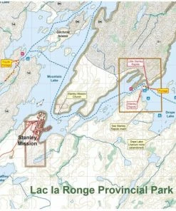
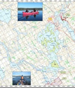
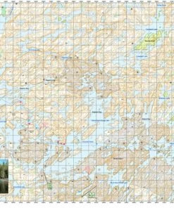
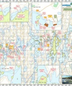
Map of Canoe routes of Fond du Lac River 1 2 3 Saskatchewan. scale 1:50,000.
Set of 3 maps of The Fond Du Lac River Area in North Central Saskatchewan, Canada. Waterfound bay to Redbank Rapids, Redbank to Brink Rapids & Brink to Black Lake. These maps are 21″ x 27″, 41″ x 15″ & 34″ x 21″ & come with a 12″ x 13″ waterproof map bag & shows suggested canoe route with forest fire burns. Maps were made in conjunction with Ric Driediger at Churchill Horizons Canoe in Saskatchewan. Scale 1:50,000.
| Paper Type | Paper |
|---|
Be the first to review “Go Trekker Fond Du Lac River 1, 2, And 3 Canoe And Kayak Map”
Related products
New

Original price was: $50.45.$42.38Current price is: $42.38.
New


Original price was: $139.81.$93.99Current price is: $93.99.
New
Original price was: $14.72.$11.48Current price is: $11.48.
New
Bushcraft
Original price was: $22.52.$15.99Current price is: $15.99.
New
Original price was: $194.19.$93.99Current price is: $93.99.
New

Trip Planning
Original price was: $14.72.$10.89Current price is: $10.89.
New

Trip Planning
Original price was: $14.72.$12.07Current price is: $12.07.
New
Original price was: $14.72.$12.07Current price is: $12.07.
Reviews
There are no reviews yet.